


Publications
Coastal Management from Space
Published on
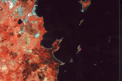
Giving Estonia, Latvia, Lithuania and Poland the opportunity to better manage their own coastal resources in an environmental and sustainable way is the aim of a project funded by the European Union (PHARE). The project is based on satellite imaging techniques to map and document sensitive coastline areas of the four countries.
Digital landscape images on the Internet
Published on
Detail-rich satellite images of landscapes and road networks will now be available quicker on the Internet, thanks to a new service called GISimages from the "Online Web Shop" of Swedish company SSC Satellitbild. All satellite images are ortho-corrected and can be used directly with geometrical reliability in a GIS (Geographic Information System).
View from the heavens
Published on
Satellite pictures of your area can now be obtained over the Internet thanks to a new service called Spacepix from satellite image company, SSC Satellitbild in Sweden. Anyone with a home computer and access to the Internet can take advantage of the new service for a small fee.
Company profile
Published on
Faster terrain relief information from Japanese satellite
Published on
The extension of its data collection capacity by SSC Satellitbild AB to include the Japanese JERS-1 satellite will allow companies faster and more reliable access to a variety of remote sensing information for geographic information systems.